Principles of Spatial Data Visualization
Spatial Data Visualization
Cartographic Principles
Geography and Geospatial Science Working Group (GeoSWG) recognised the need for best practices in cartography.
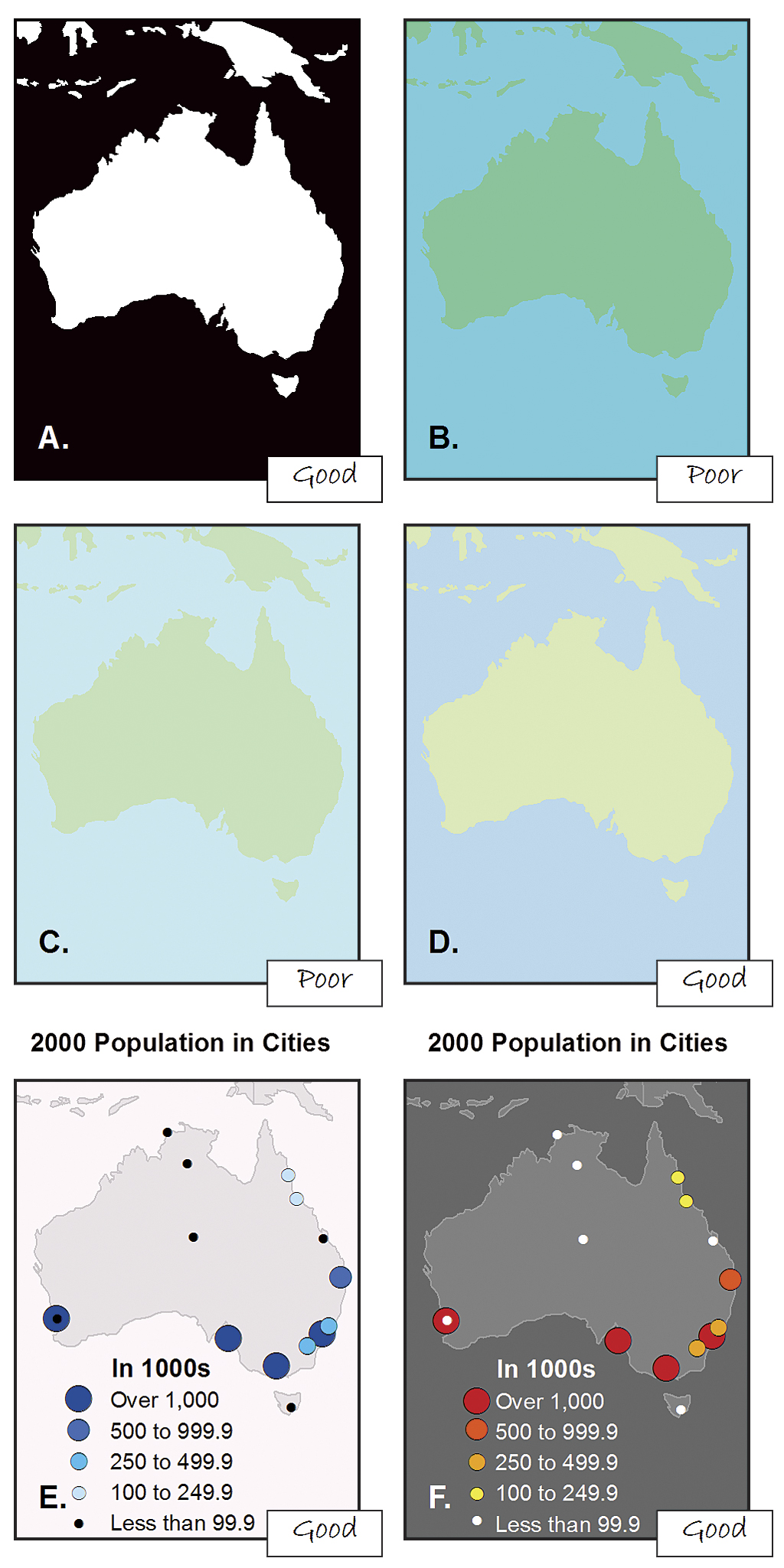
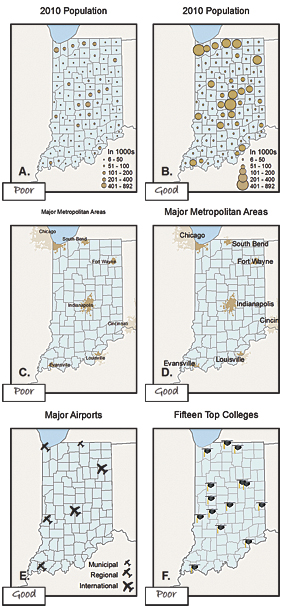
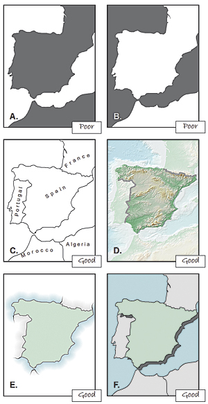
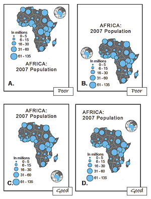
- Visual contrast
- Legibility
- Figure-Ground Orientation
- Hierarchical Organization
- Balance
These guidelines, help the researchers develop high-quality, consistent map products.
Cartographic Guidelines for Public Health
- CDC, Atlanta
- Some important aspects:
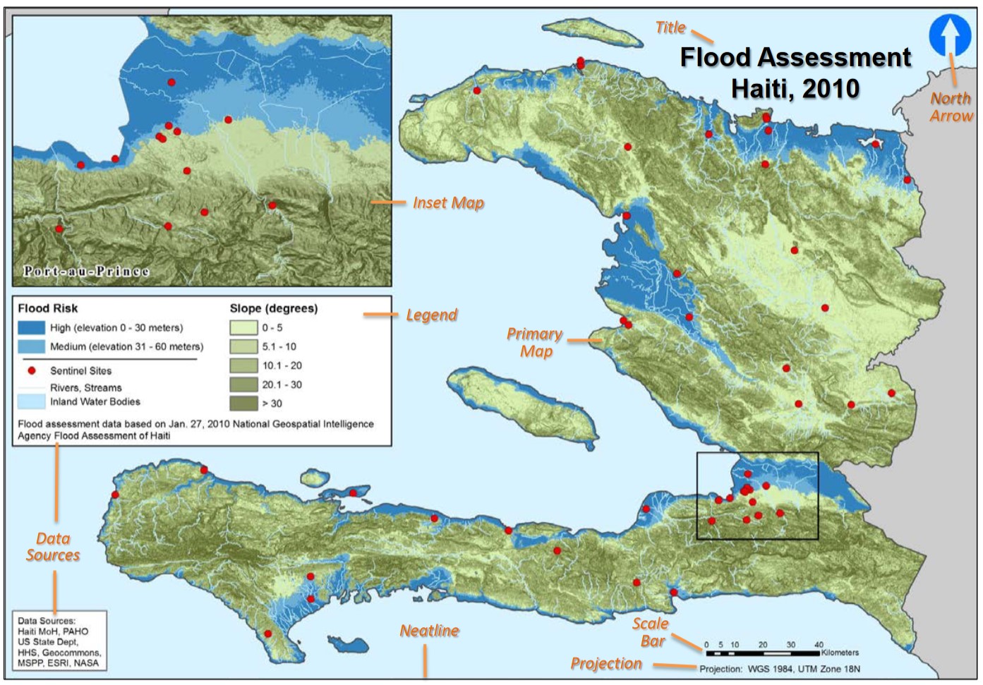
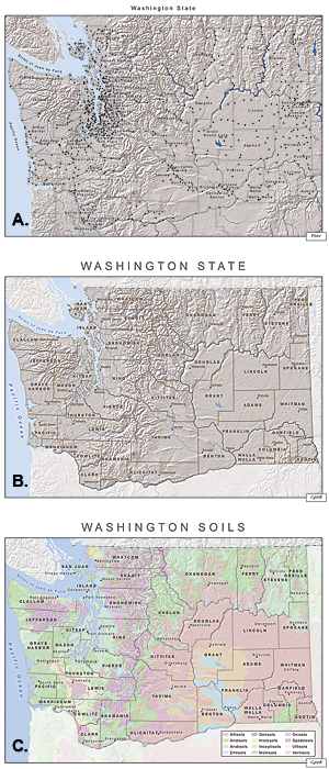
- Map Elements
- Title and Borders
- North Arrow / Graticule / Scale
- Inset Maps
- Labels and Legend
- Other Elements
- Data Sources
- Dates
- Projection
- Map Elements